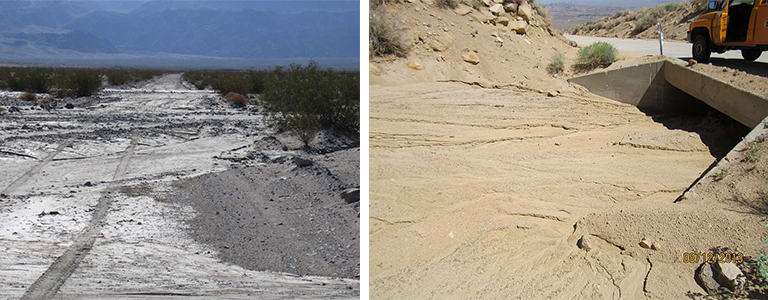
Inyo County conducted emergency maintenance on eight roads that were severely damaged by stormflows. Over 100 miles of roads were damaged by storms in the summer of 2013 and required maintenance to reopen the road to public access. The maintenance activities were funded by Caltrans and the Office of Emergency Services. Caltrans allowed maintenance to be conducted, but required after the fact surveys and environmental documentation to support funding.
Panorama conducted GIS analysis and aerial photo interpretation of pre- and post-storm aerial images to evaluate the extent of storm damage on over 101 miles of roads and quantify the area of impacts to waters of the state for after the fact permitting. Waters of the state were mapped using aerial imagery only due to the remote nature of the roads. Pre- and post-storm aerial imagery was analyzed on over 100 miles of roadway to evaluate where roadway impacts occurred in waters of the state. The GIS analysis and approach to mapping of resources and impacts was approved by CDFW. Key issues included project definition, impacts to waters of the state, and cultural resources.